


Voting District 002D, Lamar County, Texas
About
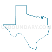
Outline

Summary
| Unique Area Identifier | 675345 |
| Name | Voting District 002D |
| County | Lamar County |
| State | Texas |
| Area (square miles) | 74.05 |
| Land Area (square miles) | 73.03 |
| Water Area (square miles) | 1.02 |
| % of Land Area | 98.62 |
| % of Water Area | 1.38 |
| Latitude of the Internal Point | 33.52280970 |
| Longtitude of the Internal Point | -95.75872240 |
Maps


Graphs
Select a template below for downloading or customizing gragh for Voting District 002D, Lamar County, Texas


Neighbors
Neighoring Voting District (by Name) Neighboring Voting District on the Map
- Voting District 0003, Fannin County, TX
- Voting District 0007, Delta County, TX
- Voting District 0010, Delta County, TX
- Voting District 0019, Fannin County, TX
- Voting District 002E, Lamar County, TX
- Voting District 002F, Lamar County, TX
- Voting District 002G, Lamar County, TX
Top 10 Neighboring County Subdivision (by Population) Neighboring County Subdivision on the Map
- Cooper CCD, Delta County, TX (3,699)
- Honey Grove CCD, Fannin County, TX (2,850)
- Pecan Gap CCD, Delta County, TX (1,532)
- Roxton CCD, Lamar County, TX (1,468)
- Ladonia CCD, Fannin County, TX (929)
- Howland CCD, Lamar County, TX (861)
Top 10 Neighboring Place (by Population) Neighboring Place on the Map
Top 10 Neighboring Unified School District (by Population) Neighboring Unified School District on the Map
- Cooper Independent School District, TX (4,731)
- Chisum Independent School District, TX (3,714)
- Honey Grove Independent School District, TX (3,402)
- Fannindel Independent School District, TX (1,467)
- Roxton Independent School District, TX (1,233)
Top 10 Neighboring State Legislative District Lower Chamber (by Population) Neighboring State Legislative District Lower Chamber on the Map
Top 10 Neighboring State Legislative District Upper Chamber (by Population) Neighboring State Legislative District Upper Chamber on the Map
Top 10 Neighboring 111th Congressional District (by Population) Neighboring 111th Congressional District on the Map
Top 10 Neighboring Census Tract (by Population) Neighboring Census Tract on the Map
- Census Tract 2, Lamar County, TX (3,552)
- Census Tract 9501, Delta County, TX (2,973)
- Census Tract 9501, Fannin County, TX (2,850)
- Census Tract 9505, Fannin County, TX (2,661)
Top 10 Neighboring 5-Digit ZIP Code Tabulation Area (by Population) Neighboring 5-Digit ZIP Code Tabulation Area on the Map
- 75460, TX (23,592)
- 75462, TX (11,350)
- 75432, TX (3,323)
- 75446, TX (3,180)
- 75449, TX (1,186)
- 75421, TX (1,003)
- 75477, TX (977)
- 75469, TX (371)
- 75470, TX (288)
- 75415, TX (144)